
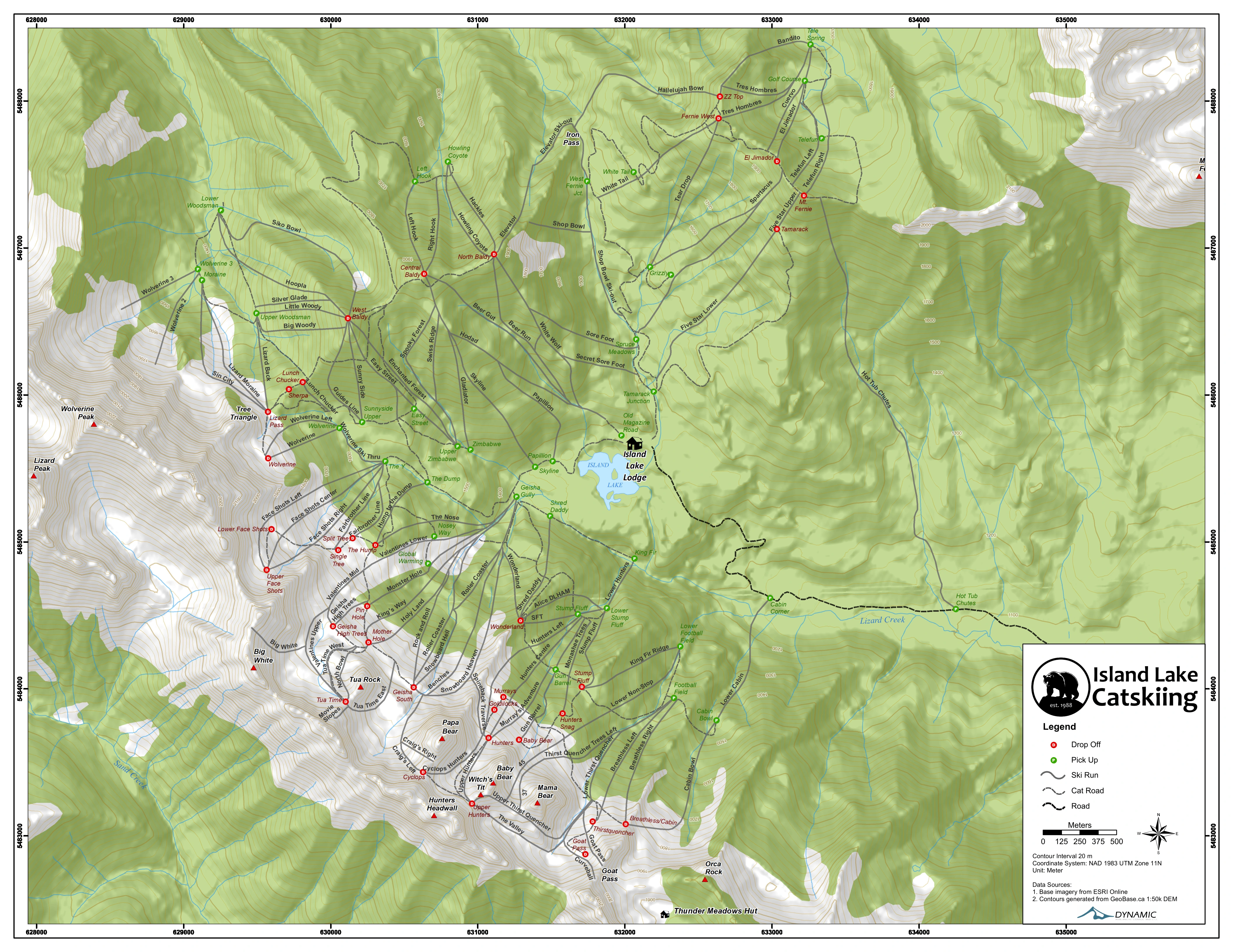
ISLAND LAKE · THE MOUNTAIN
Opening the mountain.
Loading the 3D terrain and run lines.
You can explore the trail map while you wait.
Drag to pan · Scroll or pinch to zoom
Click the map or tab to it to use keyboard controls. Arrow keys pan, plus and minus zoom. Press question mark for all shortcuts. Tab leaves the map.A LITTLE LOCAL KNOWLEDGE
The mountain sets the pace.
Explore the names and places behind a day in the cat. Guides choose the terrain each day based on snow, visibility and your group.
Run lines and cat stops are traced from Island Lake’s printed terrain map. They are approximate, sometimes partial—not surveyed GPS tracks, exact connections or boundaries. Red lines identify runs, not difficulty ratings. Run names appear as you zoom in, with overlapping names reduced for clarity; selected runs stay labeled. Labels can show across ridges for orientation. The winter treatment is a visualization, not current snow or avalanche information. This is not a navigation or access-permission map.
Open the original terrain map →Conditions & webcams →A conversation is the beginning
Who would you
bring here?
Tell us your dates, your group size, and what you have in mind.
Our concierge will help you plan the stay.