
ISLAND LAKE · THE MOUNTAIN
Opening the mountain.
Loading the 3D terrain and summer trails.
You can explore the trail map while you wait.
Drag to pan · Scroll or pinch to zoom
Click the map or tab to it to use keyboard controls. Arrow keys pan, plus and minus zoom. Press question mark for all shortcuts. Tab leaves the map.ISLAND LAKE & BEYOND
Your base for
the whole valley.
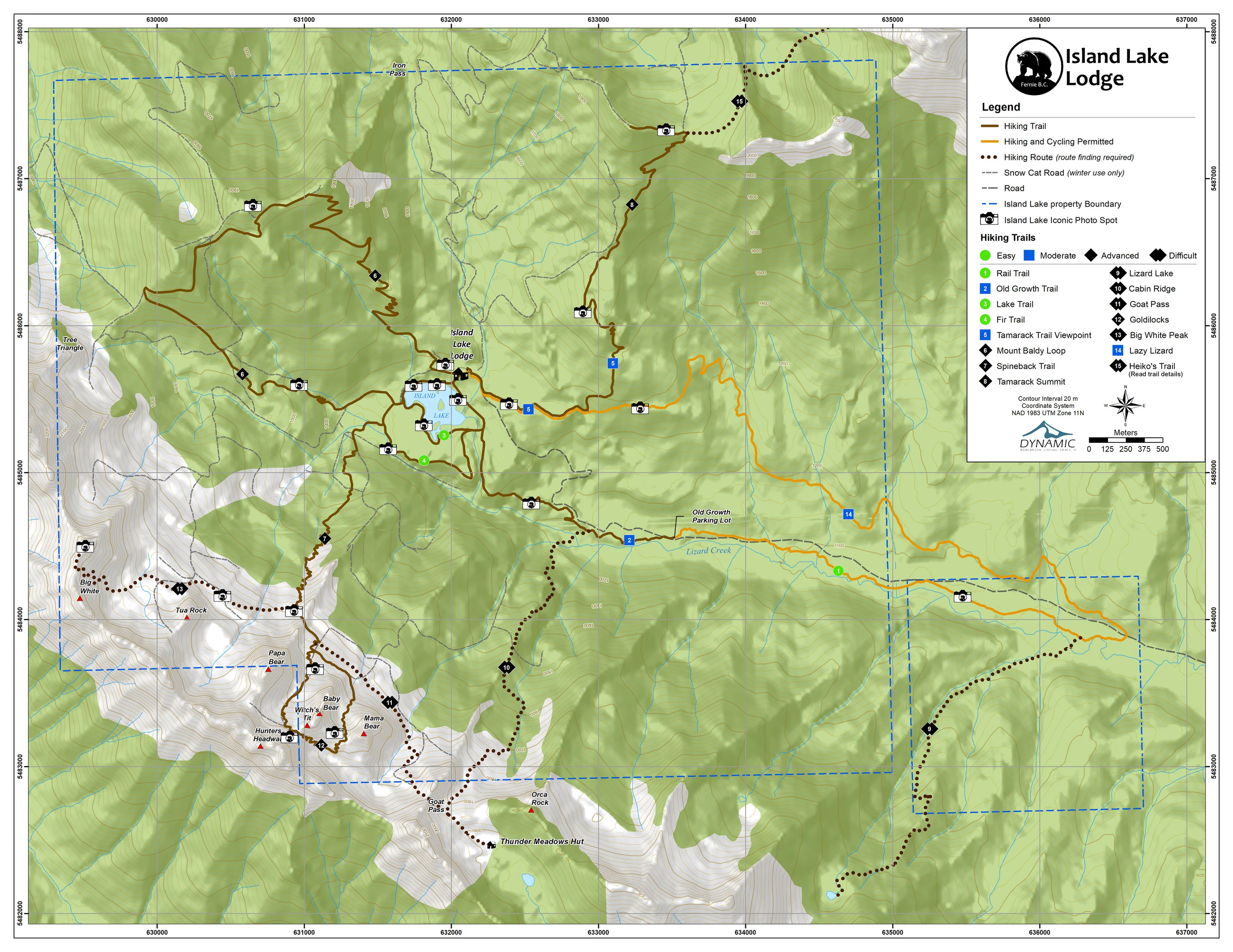
Start with Island Lake’s 15 trail profiles, or choose All Fernie to explore 212 additional named trails and connections. Browse Mount Fernie, Fairy Creek and Mount Proctor, Ridgemont, Montane and Castle Mountain, Morrissey Ridge, the resort and the northern alpine.
Choose Hiking or Biking to show trails with a mapped or checked activity designation. Grey lines in All have unverified permitted uses. Click a line or name for its profile and local guide. Regional distances describe the mapped segments, including disconnected parts where shown; add your approach, connections and return.
Island Lake lines follow its June 2024 printed guide. Regional geometry: © OpenStreetMap contributors, data dated 2026-07-24, retrieved September 25, 2026. These are planning maps, not live access reports or turn-by-turn navigation. Check signs, closures and trail ratings before heading out.
Fernie Trails Alliance · local trail information →Trailforks · current trail reports →AllTrails · complete hikes and guest reviews →Island Lake trail guide (PDF) →Download regional trail data (GeoJSON · ODbL) →Regional data licence →Conditions & Forecast →Summer Safety →